Map GIF
Deila með iMessage.
Deila með Facebook.
Deila með X.
Deila með Reddit.
Deila með Pinterest.

Deila með Tumblr.
Afrita link á klippiborð.
Afrita embed á klippiborð.
Tilkynna
Nánar
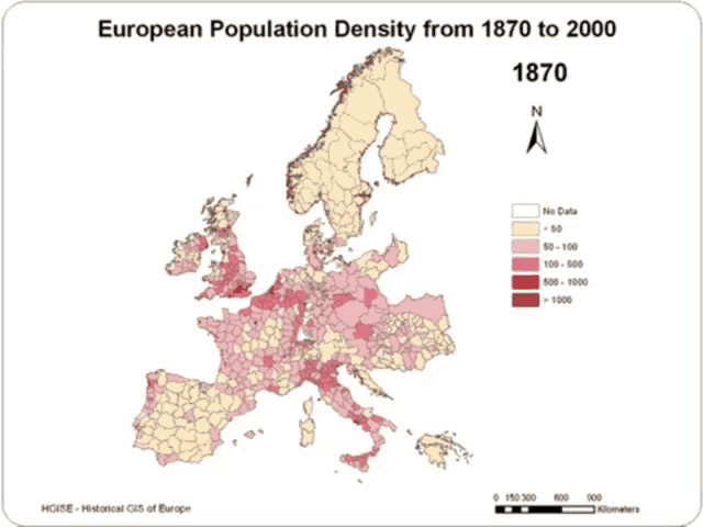
- Lýsing á efni: a map showing the european population density from 1871 to 2000
- Skráarstærð: 3246KB
- Lengd: 4.500 sec
- Stærð: 498x373
- Búið til: 2/28/2023, 2:13:01 PM